


Baboosic Greenway: Amherst North 01
| Organizational note |
|---|
| This initiative is a segment of the Baboosic Greenway regional project. |
The Amherst North 01 segment of the Baboosic Greenway is a vital initiative spanning 11,625 feet from the Bedford town line to Walnut Hill Road. This segment will utilize the historic Manchester & Milford Branch rail bed, transforming it into a shared-use path with a 10-foot-wide granular trail. It will feature a 60-foot pedestrian bridge over Baboosic Brook and a 12' x 12' box culvert beneath Camp Road to ensure seamless connectivity. The route will also leverage existing low-traffic dirt roads, Noyes Lane and Embankment Road, which are already suitable shared streets, requiring only wayfinding signage for trail continuity. A northern spur will connect to NH Route 101, offering access to the local Bragdon Farm sledding hill and LaBelle Winery. This segment will link neighborhoods near Baboosic Lake to the broader trail network, providing direct access to conservation areas, local businesses, and private recreational facilities like Camp Young Judaea.
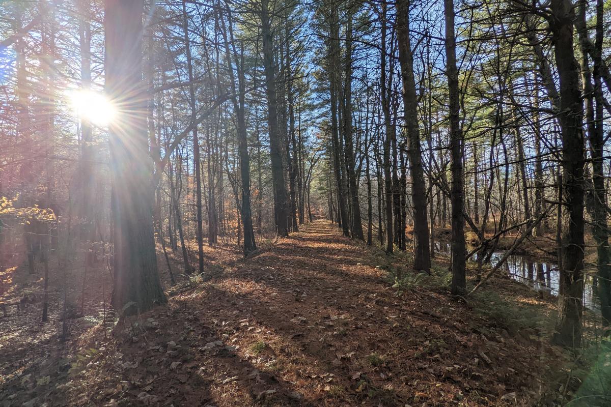
A photo of the rail trail along Amherst North 01
Location
This segment of the Baboosic Greenway is in the northeast of the town of Amherst, situated generally parallel to NH 101 to the south. It spans 11,625 linear feet from the border with Bedford in a southwesterly manner, along the abandoned Manchester & Milford Branch rail bed to Walnut Hill Rd in Amherst, where it terminates at Ten Year Plan Project Amherst 42593.
| This project connects directly to other segments of the Baboosic Greenway | |
|---|---|
| To the east | This project connects to Bedford 04 at the Amherst-Bedford town line |
| To the south | This project connects to Amherst North 02 at Walnut Hill Rd |

Map of the proposed treatments and routing of Amherst North 01.
Purpose
The primary purpose of the Baboosic Greenway stands to create a regional spine for a broader off-road trail network for the purposes of enhancing safety, increase regional mobility, and expand accessibility for persons who are unable to transport themselves by motor vehicle.
Connectivity-focused trails such as these provide area residents with a unique opportunity to move throughout their town and the region off-road, offering a peaceful journey with little or no interaction with motor vehicles. This can provide exceptionally safe and convenient mobility for multimodal users, especially if they are a member of a vulnerable population or if their route would otherwise take them along a busy roadway.
By design, off-road trails offer network connectivity opportunities beyond that of any roadway network. They provide nonmotorized transportation access to natural and recreational areas and in particularly scenic environments. These routes support outdoor activities through convenient access to natural areas or as an enjoyable recreational opportunity itself.
Often these off-road trails can become a cultural backbone of outdoor activity, providing residents and visitors opportunities to see and interact with other members of their community, something that over-reliance on motorized transportation has largely removed from our daily lives. For these and many other reasons, the safety and cultural value of off-road trails as a part of greater multimodal network cannot be overstated.
Today, the region has a robust network of off-road trails which offer a wide variety of mobility options to residents. Some trails may connect points of interest, while others may offer solely recreational opportunities. Many of these trails form an existing network that is robust in some areas and limited in others. Given the area’s largely forested and rural geography, a multimodal network limited to roadside options would fail to meet the region’s full potential. Thus, a driven and organized effort to pursue the development and enhancement of a network of trails would offer vastly expanded opportunities for our multimodal residents.
Need
As the route of the Baboosic Greenway is well defined along the Manchester & Milford Branch rail bed, the completion of each segment becomes essential in the effort to build the larger project. It will not be possible to construct this major regional project without each segment and this segment is no exception.
This particular segment of the Baboosic Greenway does offer several specific additions to the larger route, including:
- The connection of neighborhoods around Baboosic Lake to the larger Baboosic Greenway route, providing them direct access to this regional facility
- Access to Amherst Conservation Commission land, including the popular Bragdon Farm Sledding Hill, allowing visitors to access this trail directly and without parking on NH 101
- Direct access to LaBelle Winery, a locally-owned business, restaurant, and event venue
- A facility for the campers at Camp Young Judaea, a local summer camp
While the Town of Amherst is already pursuing public access along this route, the aid of the Ten Year Plan would significantly help to bolster this effort, especially considering the engineering challenges offered by its construction. The construction of the shared use path, a water crossing, and the installation of a box culvert all render this project a challenge for the municipality to handle on its own.
Data
Calculating the data of this project, linear feet numbers of each treatment are provided below:
Treatment | Details | |
|---|---|---|
| Full segment extent | 11,625 linear feet | |
| Including | Shared-Use Path (Crushed Stone, 10’ typical section with 2’ shoulders) | 6,160 linear feet |
| Right-of-way only (Along existing, low-volume private dirt streets) | 5,329 linear feet | |
| Midblock Crossing (at Walnut Hill Rd) | 1 | |
| Bridge (over Baboosic Brook) | 40 ft span | |
| Box Culvert (12’x12’ size, beneath Camp Rd) | Approx. 40 ft span | |
Project Status
The current status of Amherst North 01 is as follows:
| Date | Update |
|---|---|
| 2024-July | This project was submitted for addition to the Ten Year Transportation Improvement Plan (TYP) |
| 2022-May | This project was added to the Nashua regional Metropolitan Transportation Plan (MTP) |
| 2022-May | This project was submitted for addition to the Ten Year Transportation Improvement Plan (TYP) but was not selected due to funding limitations |
| Attachment | Size |
|---|---|
| 6.03 MB |