


Caesar's Brook Trails
Map: Open Street Map
Map: NRPC Map
Map: Caesar's Brook Kiosk Map
Length: Caesar's Brook Trail about 1/2 mile.
Length: Caesar's Brook Trail about 1/2 mile.
Stone Wall Trail about 3/8 mile.
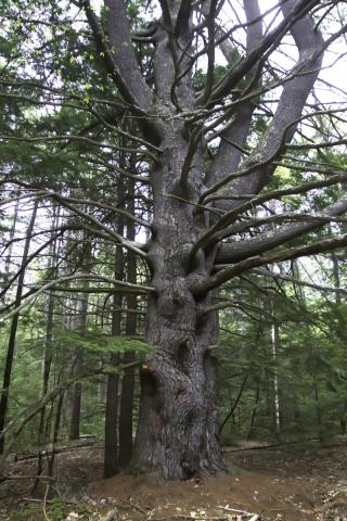
Wolf Tree Trail less than 1/4 mile.
Most loop choices yield about a 1 mile walk.
Identification:
Identification:
Caesar's Brook Trail - White blazes.
Stone Wall Trail - Red blazes.
Wolf Tree Trail - Yellow blazes.
Difficulty: Walking: Easy.
Difficulty: Walking: Easy.
XC: Not recommended.
Biking: Mostly easy.
Location: Parking lot and trailhead are located on Mont Vernon Road near the intersection with Eaton Road. Parking for 4 or 5 cars at trailhead, roadside parking on Eaton Road across from the trailhead.
Description: From the parking area walk down the old logging road to begin the white-blazed Caesar’s Brook Trail. You will pass a clear-cut wildlife habitat area on the right and a small field on the left. Just beyond the field, the red-blazed Stone Wall Trail takes off to the left. Here we can (a) continue on Caesar’s Brook Trail or (b, see below) take a left onto the Stone Wall Trail. Continuing on the Caesar’s Brook Trail note the huge White Pine tree on the right side of the road at the top of a rise. Keep an eye out for porcupines. The first quarter mile or so of the trail is mostly deciduous forest, dominated by Beech trees. You’ll pass another clear-cut area on the left just before the trail starts downhill, alongside yet another clear-cut area, down to Caesar’s Brook itself, as you enter the hemlock forest that covers the majority of the Caesar’s Brook Reservation. You will notice that another brook (name unknown by me) feeds into Caesar’s Brook, the confluence being a beautiful place to stop and meditate awhile. A few steps south alongside the brook you’ll find a bridge crossing over to the east side of Caesar’s Brook. From there the trail wanders up through the woods and along a high ridge with lovely views down below before wending back down to the brook and following it north, past the entrance to the Wolf Tree Trail. Along the brook you’ll see beautiful small waterfalls and an ox-bow. The trail ends at a three-way intersection with the Stone Wall Trail and the other end of the Wolf Tree Trail. Take a right here onto the Wolf Tree Trail that runs through lovely hemlock woods over to the high ridge, then south along the ridge and over to the particular wolf tree that gives the trail its name, a magnificent old White Pine tree. The trail then takes you back down and ends at Caesar’s Brook. Now let’s talk about the Stone Wall Trail (b). It takes off to the west from Caesar’s Brook trail through a young deciduous forest and rises up to a ridgeline that runs north along stone walls until winding back down through another wildlife cut. It then enters the hemlock forest. Notice that almost all the new growth in this forest is young hemlock trees. After a pleasant walk crossing two bridges over the two brooks, you arrive at the three-way intersection mentioned before. Study the map and put these trails together into an hour or two of healthy activity in a beautiful natural environment.