


Arnold Trail and Arnold Loop Trail
Map: Open Street Map
Map: NRPC Map
Map: Betty Arnold Forest Kiosk Map
Length: 1 mile loop
Identification: Blue blazes.
Difficulty: Walking: Moderate.
Length: 1 mile loop
Identification: Blue blazes.
Difficulty: Walking: Moderate.
XC skiing: Moderate.
Mountain biking: Moderate.
Directions: Rt. 101, left on Horace Greeley Road, left on Nathaniel Drive.
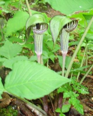
The Arnold Trail provides a one-mile loop walk through a mixture of maturing woods. The trail also provides an alternate access to the Bicentennial Trail from Nathaniel Drive. Within short distances, different stages of forest development will be encountered and the effect changing soil moisture level has on tree species can be readily observed. The land of the Arnold Reservation was purchased in 1985 by the ACC with Land Account funds. It is named for Elizabeth Arnold, one of the first ACC commissioners.
Log: A trail sign on the left shoulder of Nathaniel Drive one-half mile from Horace Greeley Road marks the start of the Arnold Trail. The trail descends a flight of stairs from the roadside into a gully. After crossing a seasonal stream the trail begins a rise under tall hemlocks and white pine. In 300 feet, an abrupt change occurs as we enter an area selectively logged in the late 1980s. Note here how the increased sunlight encourages a greater species diversity. The trail passes between two larger red oaks at 700 feet and turns left uphill. At this point the Lorden Path leaves on the right (west) to connect with the Bicentennial Trail. As we go up, the soil becomes drier and drier. Fewer soft woods are seen and more hardwoods – birch, ash, maple and oak – are noticeable.
At .25 miles a solitary mountain laurel is testament to a once more open landscape. Note also as you walk the occasional tangled skeletons of field juniper, remnants of the days when the land was a pasture. The returning loop trail enters from the right near the height of land. Notice too, the white ash in this area where many have died and few are healthy showing the effects of ash decline. The trail reaches its high point where young white pines are slowly creating a future pine stand. Each horizontal branch on a pine marks the growth of the tree in one year. Compare the growth here to that on trees seen elsewhere in moister, sunlit areas where the growth may be two feet in a year. Turning right, the trail drops back into moister woods with a more lush understory of shrubs and ferns. Continuing straight ahead, the trail briefly joins the Bicentennial Trail.
At .25 miles a solitary mountain laurel is testament to a once more open landscape. Note also as you walk the occasional tangled skeletons of field juniper, remnants of the days when the land was a pasture. The returning loop trail enters from the right near the height of land. Notice too, the white ash in this area where many have died and few are healthy showing the effects of ash decline. The trail reaches its high point where young white pines are slowly creating a future pine stand. Each horizontal branch on a pine marks the growth of the tree in one year. Compare the growth here to that on trees seen elsewhere in moister, sunlit areas where the growth may be two feet in a year. Turning right, the trail drops back into moister woods with a more lush understory of shrubs and ferns. Continuing straight ahead, the trail briefly joins the Bicentennial Trail.
At .5 miles the alternate return loop leaves the Bicentennial shortly on the right. The alternate leg of the Arnold loop, which provides a varied return route to Nathaniel Drive, generally follows the edge of a large swamp. There are points along the trail that allow bird watching over the wetland shrubs. Sphagnum moss, cinnamon fern and mountain laurel are common beside the trail, which may become water covered in spring. Century-old large oaks, pine and hemlock have taken advantage of the moisture here and the shelter from storm winds. At the trail junction go left to Nathaniel Drive.