


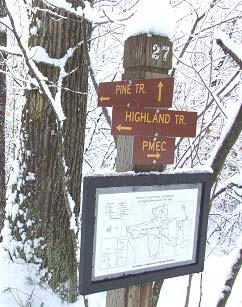
Highland Trail
Map: Open Street Map detail
Map: NRPC Map detail
Length: 1.8 miles. Post 6 on Old Brook Road to Post 24 on Brook Road
Identification: Blue Blazes
Difficulty: Walking: Moderate
Identification: Blue Blazes
Difficulty: Walking: Moderate
XC: Moderate to difficult
Mountain biking: Not allowed.
The Highland Trail climbs from the elevation of Joe English Brook to the top of the hill east of Brook Road. It then travels south along the ridge returning to Brook Road .6 mile south of PMEC. The trail connects to several other trails forming the backbone for trails in the Harding and Plumb Forest sections of Joe English Reservation.
LOG:
The Highland Trail leaves Old Brook Road Trail 700 feet north of the PMEC kiosk, at Post 6. Shortly, the trail crosses Joe English Brook (bridge may be slippery as are the bog bridges ahead) in an area once flooded by water behind the Peabody Mill dam. Porcupines have pruned the young hemlock in this area. After a short, steep ascent the trail reaches an old wood road and the junction with the Pine Trail (yellow) at Post 11. Note the granite culvert carrying a seasonal stream under the old road.
At .25 miles, Post 12, the Ledge Trail (red) exits left with a view to the west. Pass through a stone wall and turn right. Climb to Post 13 at .4 miles where the Harding Loop (yellow) exits left. At .55 miles, Post 14, the Pine Trail (yellow) reenters on the right.
At .25 miles, Post 12, the Ledge Trail (red) exits left with a view to the west. Pass through a stone wall and turn right. Climb to Post 13 at .4 miles where the Harding Loop (yellow) exits left. At .55 miles, Post 14, the Pine Trail (yellow) reenters on the right.
At .6 miles, Post 15, the Harding trail on left rejoins the Highland Trail. The Pine and Harding trails were originally developed with XC skiing in mind. The trail reaches a high point at .75 miles and turns right dropping into a swale and crossing the stream. Note the larger trees here where moisture and shelter from winter winds are benefits. The trail climbs with ledges on the left and more trees showing cropping by porcupines.
At 1.2 miles, reach Post 16 and the junction with the P-H Trail (orange). In 200’ more at Post 17, a short connector to the Plumb Trail leaves left. The main trail continues first south and then westerly with views to Mack Hill and Joe English West. Note heavy growth of lichen and moss on the shaded ledges.
At 1.3 miles, the trail drops first steeply, passes ledges blanketed with rock tripe and then drops more steeply. At a granite bound, the trail turns left reaching the junction with the Plumb Trail (red) at Post 18. Trailing arbutus, also called mayflower, is a prevalent ground cover in
this drier area. Turn sharp right and drop steeply to Brook Road at Post 24, 1.8 mile from the trail start. Go right on Brook Road .6 miles to return to PMEC.